
Haines City Past-Resident Sources
One source rarely names every person tied to a Haines City address. Property and deed records establish ownership, while census schedules and city directories can reveal households. Permit files date work and identify applicants or contractors, not necessarily residents. A search for previous residents should begin with the source closest to the year in question, then anchor each name to the same parcel or legal description.
| Source | Years It Covers | Where Held | What It Shows |
|---|---|---|---|
| Official Records | 1957-present | Polk Clerk online | Deeds, mortgages, liens, plats, judgments |
| Historical Deeds | 1861-1956 | Polk Clerk online | Early grantor and grantee chain |
| Property roll and GIS | Current; sale history varies | Polk Property Appraiser | Owner, situs, mailing, legal description, buildings |
| Federal census | Through 1950 public | NARA, FamilySearch, library | Household members, ages, kin, occupation |
| Directories and reverse books | Exact local run unverified | Libraries and History Center | Occupant, address, work, telephone |
| City permits and code files | Online cutoff unverified | Haines City portal or request | Work, owner, applicant, contractor, liens |
For a recent question, start with the parcel card and present owner's acquisition deed. For a mid-century trail, use the Clerk's modern index, then directories and the 1950 census. Before 1957, switch to Historical Deeds. Early research may need Polk County or rural geography because Haines City did not incorporate until 1914.
Start Haines City Address History
The Polk Property Appraiser is the best first stop because deeds are indexed by party names and legal descriptions, not reliably by a modern street address. Search the site address and save the parcel ID, exact owner spelling, mailing address, situs address, subdivision, lot and block, legal description, last sale, and homestead status. Situs means the property's physical location. Mailing is where tax notices go.
A mailing address can help locate an owner elsewhere, but it does not establish who occupies the Haines City property. Likewise, a homestead exemption supports owner occupancy without proving it. The example parcel card below shows the kinds of fields that should be copied before searching past residents.
Inspect the official Polk example parcel card.
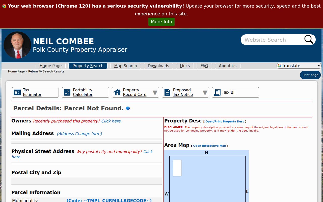
The card turns an address into durable identifiers that can survive a ZIP, street label, or jurisdiction change.
Trace Polk County Past Owners
The Polk County chain of title reaches back through two online eras. A chain of title is the linked sequence of transfers for the same land. Start with today's owner, open the acquisition deed, and identify the seller. Then look for that seller's earlier purchase as a buyer. Dates and names alone are not enough; the legal description must keep matching.
- Copy the current owner, parcel ID, sale date, and full legal description from the property card.
- Find that owner's acquisition deed in Polk Official Records. Confirm the parcel and save instrument or book and page.
- Read the grantor, the seller, then search that name as an earlier grantee, the buyer.
- Repeat the match through 1957, checking the deed image and legal land description at each transfer.
- Cross into the Historical Deeds search for 1861 through 1956 and continue with grantor, grantee, and book-page references.
- Grantor and grantee
- The grantor gives or sells an interest; the grantee receives it.
- Chain of title
- The linked record of transfers affecting the same parcel through time.
- Legal description
- The lot, block, subdivision, or metes-and-bounds text that identifies land independent of a postal address.
Quitclaim, corrective, trust, and estate deeds may change title without a move or market sale. Mortgages and satisfactions bracket financial activity but do not transfer ownership. Record deed type and consideration, and keep confidence notes when a link is uncertain.
Review the Clerk's Official Records search help.
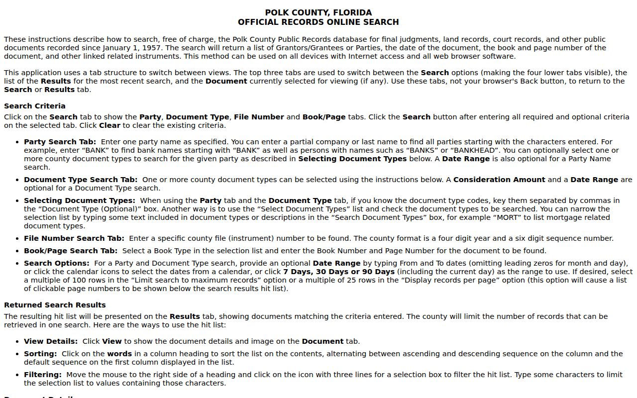
The help screen clarifies the index fields and image workflow used to follow one transfer to the next.
Haines City Deeds Cross 1957
The Polk Clerk Official Records page separates modern recorded documents from Historical Deeds. Modern Official Records start January 1, 1957 and include images unless access is restricted. The Historical Deeds path spans 1861 through 1956. Together, the systems reach back to Polk County's creation.
Older deeds often omit today's street number. Preserve book and page, both parties, and the full legal description. A seller-name search alone can mix unrelated people. Within modern results, linked instruments and images can speed the work, but each transfer still needs a parcel match.
See the Clerk's two deed-search choices and coverage.
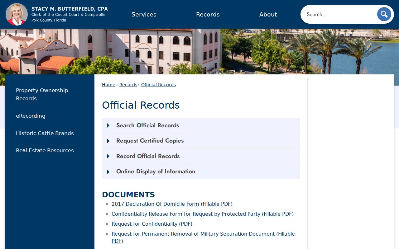
The displayed split marks the exact point where a backward Haines City search changes systems.
Date Haines City Houses
Maps and permits help explain the building, not just the owner. Haines City's permit portal can be searched by permit number, date, contractor, site address, applicant, or issue date. Results may show site address, project name, and review status. Request the underlying application and inspection history when the public result is only a summary. A permit identifies an owner, applicant, or contractor at a point in time, but it is not proof that the person lived there.
A verified 1917 Haines City Sanborn map shows downtown footprints, construction material, use, and older labels. Evidence also points to a 1923 set, though research did not establish the full local map run. Compare footprints and street labels with the parcel's legal description.
Open the Library of Congress 1917 Haines City Sanborn image.

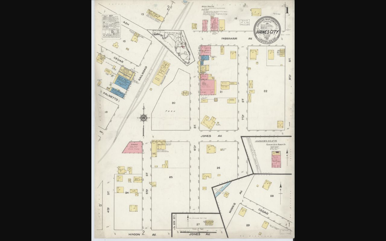
The map can date a structure or street label, while deeds and directories supply the people tied to it.
Haines City Address Changes
A Haines City mailing name is not proof that the parcel lies inside the legal city boundary. ZIP delivery areas cross municipal lines, and annexation may change government jurisdiction without changing the mailing city. USPS also realigned the Haines City 33844 and Lake Alfred 33850 boundary effective January 7, 2006. A different ZIP before and after that date does not by itself mean a previous resident moved.
When an old address fails, return to the parcel ID, subdivision, lot, block, and deed description. Search historic maps and directories for street variants. No authoritative citywide street-renaming chronology was found, so do not invent one. Pre-1914 searches should also use Polk County and rural terms; for the late nineteenth century, test Clay Cut, the settlement's earlier name.
Search tip. Carry the legal description through every step because it survives postal, street-number, and boundary changes better than the address string.
Haines City Household Trail
Owners are only one layer of previous residents. A reverse or criss-cross directory arranges entries by street and house number, which may reveal an occupant who never held title. Exact Haines City runs were not verified, so contact local libraries and the Polk History Center with the address and year. The known directory evidence is scattered across 1886, 1913, 1921, 1925, 1963, and 1993 rather than a proven continuous set. This is often the best way to identify past residents between census years. The collections and their limits are detailed on the Haines City city directory page.
Pair a directory point with the nearest public federal census. The 1950 census is the latest open population schedule. Copy every household member, relationship, age, and address, then compare those facts with deeds and later directories. An enumeration district is the geographic area assigned to one census taker; it can help browse schedules when a name index fails.
- Fix the parcel and its address as printed in the target era.
- Find the closest directory or telephone-book entry and save its full citation.
- Check the nearest census schedule by name, address, or enumeration district.
- Compare kin and age facts, then test the next available directory year.
- Record gaps as unresolved instead of assuming a move or death.
Lawful use. Research previous residents for house history, genealogy, estate questions, or personal curiosity. Never use an address trail to harass, threaten, or track a living person.
Close Haines City Resident Trails
When an owner dies, probate and recorded transfers can identify heirs and explain the next deed. Search the Polk Clerk's probate docket, then compare the decedent, petitioner, legal parcel, and transfer documents. Obituaries can add relatives and prior residences, while cemetery records provide a separate date and place check. None should be treated as complete alone.
Haines City put cemetery grave data online in 2016 and added kiosk and QR access in 2021. A last-name search may return cemetery, block, lot, space, and GPS coordinates. Forest Hill and Oakland are city-managed cemeteries. Confirm spelling variants and possible reinterments with cemetery staff.
View Haines City's official cemetery information and burial-search links.
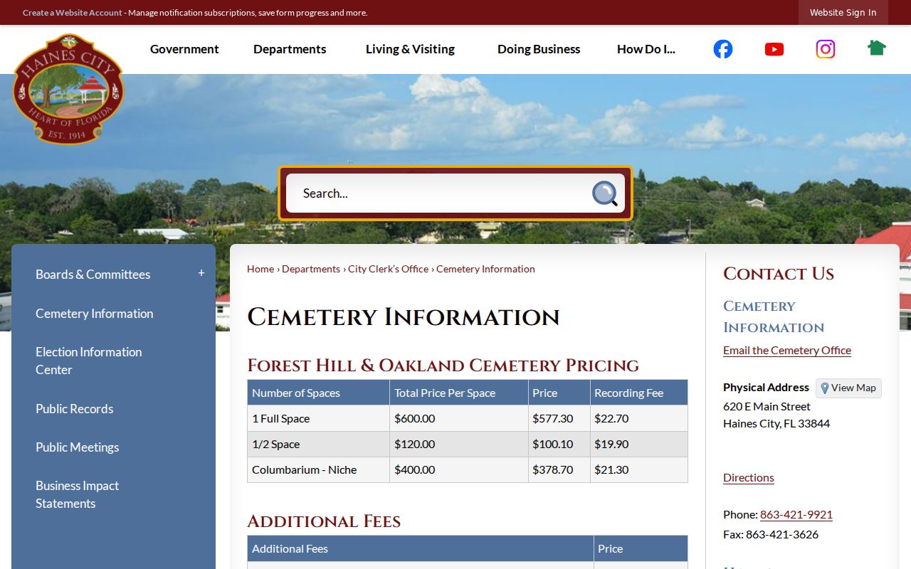
The city resource can close a household trail with burial details that can then be checked against probate and obituary records.